Tuesday, July 26, 2011

July 26, 2011

Start: 1178
End: 1197

Today was the early start we had been looking for the past few days. We were up at 5:30am and on our way at 6:30. It was a very cruisy day which involved a few rolling hills early on before turning into a long descent down to Hwy 49, 1.5 miles east of Sierra City.

After the first few miles we dropped below the snowline and enjoyed the longest stretch of snow-free trail since Kennedy Meadows around mile 700. As we dropped elevation we seemingly walked into another world and it really felt like we transitioned into Northern California and out of the Sierras. The forest got thicker and there were ferns and other understory reminiscent of the NW.

Since the miles were easier we made our 19 for the day by 3:40pm and into town around 4pm in time to pick up our packages, buy some ice cream, and check out the Red Moose Restaurant/Inn. Amazing! Margaret and Bill bought the Red Moose last year and inadvertently started feeding, and then hosting, hikers. This year many hikers have been looking forward to the ribs they make here and the overall hospitality they provide. This year they enlisted the help of a 2010 SOBO thruhiker, Coach K, to help out during the busy hiker time. They have showers, laundry, food, a place to hang out inside, and camping in the backyard. It is a welcome surprise to me!

Thanks to my sister's family for the delicious goodies in the care package and my mom for more dried goods to add to meals (as well as the maps)!

If anyone else wants to send packages, the zipcode for Seiad Valley is incorrect! The correct zipcode is 96086. Also, I'm about two weeks behind my original schedule, but still on the way!

Back on the trail tomorrow!

Misspellings brought to you by iPhone

July 25, 2011

Start: 1159
End: 1178

Woke up today feeling refreshed and ready to hike! Today we had a series of rolling hills, going up a few hundred feet before descending again.

After going over Castle Pass we made our way down to Peter Grubb hut. The hut is on Forest Service land, managed by the Sierra Club, and very cool. It's rented out during the winter for those wanting to brave the four mile trail in the snow. We stopped to have a snack there before moving on.

As usual, we came across more snow today. We only got off track a few times while going through the snow in the trees, one of which being because we followed some errant footprints. Being on the snow today, not able to see the trail, made me think of Matt and Julie who hiked the PCT in '07 and just finished the AT this summer. 2007 was a dry year and they were able to make their way along the trail using the data book as their main (only?) source of navigation. That would simply not be possible this year. If you can see the trail than the data book would work just fine, but when the trail is covered in snow more often than not, maps are definitely necessary, and GPS is a nice thing to have on hand.

On another of the descents, we dropped into Paradise Valley. It was nice enough, but calling it paradise may have been a bit optimistic due to the snow and mosquitos. I'm sure it will be perfectly nice in September.

Another thought I had today was regarding enjoyment while hiking. I have come to the conclusion that there are two things that determine how much you will enjoy the hike: food and sleep. If you take in the correct number of calories, and nutrients, for your workload so that you are never very hungry, you will feel energetic and ready to hike! Same goes for sleep; if you get enough given your workload, you will wake up in the morning ready to go!

We got to camp earlier, and for some reason on top of the forested, snow-free saddle the mosquitos were particularly bad, so refuge was taken in the tent and a moquito melee ensued. Once they were smeared across the walls of the tent, sleep came quickly.


Misspellings brought to you by iPhone

July 24, 2011

Start: 1138
End: 1159

We began the day climbing up a hill and then ran into some snow. Just into the snow we ran into two ultra running women coming down from a morning run. They immediately asked if we came from Mexico, to which we said yes. It was the first of three times we had similar comments.

After hiking past the runners we were following some footprints without thinking too much about it and eventually came to a ridge. The footprints ended. We checked the maps and looked at the terrain, and found that we were on the wrong ridge! Squaw and Granite Chief Mountain were just to the right, across the valley from where we were standing, so we backtracked and descended the snow and across to the other side where we eventually found the trail and made our way up to the top of Granite Chief and down below a chair lift.

After a bit more hiking we made our way up another ridge and past Tinker Knob. We followed the ridge for a while and enjoyed the views on either side. Towards the end of the ridge walk we passed another ski resort, Sugarbowl.

After passing Sugarbowl we started making our way down to Hwy 40 (Donner Pass). We stopped to eat dinner before continuing on to Hwy 80 to complete Section K, 3 miles up the trail.

Upon nearing Hwy 80, we didn't have the same misfortune as the Donner party, but did find our way to the wrong trailhead 3/4 miles from where we were supposed to cross the highway.

After that mishap, it was getting dark, so we made our way back down the trail and across the highway before finding the first suitable place to camp, still in earshot of 80.

I was exhausted and frustrated with myself for going the wrong way earlier and fell asleep as soon as possible. Luckily tomorrow is a new day.


Misspellings brought to you by iPhone

July 23, 2011

Start: 1113
End: 1138

Today was a good day. We got started about the same time as yesterday, and as we were packing up we met Flash, Crasher, Let It Be, and Driftwood Dog.

The morning's hike was pretty easy and we walked through trees up until we got to Barker Pass where we stopped to eat lunch. Beyond Barker Pass we started getting some good views. The days hike took us up then down, and then up again to a ridge where we crossed over into the Granite Chief Wilderness. The majority of the ridge walk was amazing! There were all kinds of wild flowers, and we were walking the last part of the ridge as the sun set behind a ridge across the valley we ended up descending. Along the way we hiked by Alpine Meadows Ski resort and saw Squaw Valley resort on the next ridge over.

Since we were up on the ridge we needed to get in a few more to get down off the ridge so we could find a flat place to camp. Since it was getting dark we got in a little night hiking to get down, scrambling through snow and rocky hillsides until we found the trail again and a good place to camp by the river. We were both ready to camp when we found a dry spot and fell asleep quickly.

Misspellings brought to you by iPhone

July 22, 2011

Start: 1094
End: 1113

Today we hit the trail again! We slept near where we had been dropped off and continued on our trek in the morning. Despite our well intentioned plans, we didn't get on the trail until 7:30am.

It took me a while to get my hiking legs back after taking a few days off. We passed Echo Lakes early in the day, ran into many day and weekend hikers, and continued on up in to Desolation Wilderness. The lakes were all beautiful, unfortunately the mosquitos must have thought so too, because we saw a fair amount of them.

The excitement of the day started when 12 Ounce and I split after having lunch at Heather Lake. We each had new books on tape to listen to, so we plugged in our earbuds and started walking up and over Dicks Pass with the intention of meeting on the other side at Dicks Lake.

I waited around Dick Lake for a while, backtracked a bit, and figured that she had probably kept on going, following other footprints she thought were mine.

We were able to reconnect down the trail later around 8pm, much to my relief. I was really hoping I hadn't ditched 12 Ounce on accident!


Misspellings brought to you by iPhone

July 18-21, 2011

Spent the last few days off trail in Los Altos doing some relaxing and major planning for the rest of California. I bought 28 days worth of food, repackaged it, and sent it on to the next few resupply locations. It was quite an undertaking and took a couple days to finally get all put together.

Also saw a couple friends, Fatty and Kyle. It was good to see some familiar faces, even if mine didn't look all that familiar.


Misspellings brought to you by iPhone

Wednesday, July 20, 2011

July 17, 2011

It was a leisurely morning at the Silver Lake cabin, eating breakfast and changing back into our hiking attire.  Around 7:30am, David drove us back to the trail and we were on our way to Echo Pass.

Monument to Snowshoe Thompson at Carson Pass


With only about 15 miles to go to get to Echo Pass it was a very leisurely day.  Not very far into the hiking for the day we joined up with the Tahoe Rim Trail (TRT), which circumnavigates the lake.  The circumference of the lake is about 72 miles, while the trail is 165.  Being a Sunday, we ran into quite a lot of hikers out for weekend trips to various lakes, or doing part of the TRT.  It's always fun to talk to weekenders and hear about their travels.  It seems that usually they are coming from a lake not too far away, and plan to hike in a day the amount we have already hiked by lunch.  It's also interesting to get their assessment of trail conditions.  We talked to a couple groups of people who warned us about the upcoming snow on the trail past Showers Lake, who inquired whether or not we had a GPS because navigation was difficult.  To be fair, there did end up being a fair amount of snow, but with well worn footprints and past experience finding the trail, there was little trouble with navigation.

First view of Lake Tahoe in the distance


Sign at the junction with the Tahoe Rim Trail

Meiss Cabin near the TRT junction


We took a nice a long lunch to relax, not in a hurry to get into Tahoe until dinner time, and I was able to get a hold of a friend, Katie Kuchenbecker, who offered a ride to/from the trail and a place to stay.  After the siesta, we continued the remaining 6 miles to the trailhead at Echo Summit (Hwy 50), which was almost all downhill.  With just over 3 miles left, we ran into a couple who had started from Carson Pass just after us.  They were a bit lost and asked us if we knew where we were going, to which we said yes, and then they asked if they could follow us down.   12 Ounce led the way and after descending some steep, snowy switchbacks and getting down to flatter ground.  We followed a creek for a while, then found the trail again, and took off ahead of the other hikers once they were back on the trail as well.

Good thing there was a trail sign to tell us the trail was straight through this section, especially since there were no intersecting trails


Once at the trailhead, we were just starting to hitch, when a car pulled into the trailhead, then turned around and was about to leave.  12 Ounce jumped on the opportunity and we were able to get a ride down to Meyers with two guys in their 20's.  Once in Meyers, I checked the address Katie had given me, and lo and behold, her house was less than half a mile from where we were dropped off!  We decided to walk rather than call for a ride so that it would be more of a surprise when we showed up.

We hung out at Katie's for a bit, then went to dinner at Orchid Thai, followed by the Snow-Flake drive-in for a malt.  Back at Katie's we talked a while longer before heading to bed, since it was past our hiker bedtime and Katie had work in the morning.


July 16, 2011

Start: 1063
End: 1078

David wasn't able to eat  much last night and his legs were feeling pretty heavy, so he made a contingency plan to get picked up at Blue Lakes Road, 4 miles up the trail, rather than continue to Carson Pass per the original plan if he wasn't feeling up to it.  It's not an easy thing to jump right into hiking 13+ miles a day, particularly for multiple days in a row.

When we got to Blue Lakes Road, David reevaluated how he was feeling and decided that there wasn't enough time for him to make it Carson Pass.  If we had another day everything would have worked out, but the timeline was already set and we needed to get to Carson Pass, as did David so he could meet up with the rest of the family and head to Squaw Valley the following day. Once we parted ways with David, we headed up past the Nipple above Blue Lakes, and continued on toward Hwy 88.

The Nipple

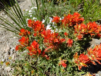
Paintbrush


Upper and Lower Blue Lakes from our lunch location
There was more snow than yesterday, but we still also saw our fair share of wildflowers as we made our way along the trail, around Elephant's Back.


Elephant's Back


Mule's Ear


Paintbrush
We arrived at Carson Pass right at 4pm and had just sat down when David and Janet showed up bearing gifts of coconut macaroons, rocky road ice cream, Gatorade, and  Newcastle Brown Ale! They also offered us a warm place to sleep at Silver Lake just down the road, where they were spending the night courtesy of David's mom (my aunt) Sally.  We gladly accepted the offer and hung out at the pass with some other hikers while David and Janet drove back to Ebbetts Pass to retrieve David's car.

At Silver Lake we met up with Sally, as well as David and Janet's two daughters Lauren (age 3) and Sarah (age 1). We had a little bit of story time, along with showers, followed by David treating all of us to dinner at the restaurant at Kit Carson's Lodge, which was amazing! Following dinner we went back and ate some brownies and macaroons to finish off the night, before falling asleep with full bellies in a warm cabin overlooking the lake.  What an amazing day and great trail magic!

July 15, 2011

Today we woke up early and were on the trail by 6:15am so we could get in the 7 miles to Ebbetts Pass by 9am when I was planning to meet with David.  It was more up and down than I was expecting and took a while, but it was beautiful and I made it with time to spare.  


When I got to Hwy 4 (Ebbetts Pass) I ran into Doug, Fritz, and Shepherd.  Doug was setting up trail magic just as I was arriving, while Fritz and Shepherd were preparing to hike the section between Ebbetts Pass and Carson Pass.  Shepherd is also a trail angel who supplied us with food near Silverwood Lake many miles ago.

A few minutes later David pulled up with goodies in tow and ready to hike.  There were peaches, apricots, pineapple, strawberries, homemade brownies courtesy of Janet, and Gatorade.  After spending a little time at the roadside, we headed off to start the section.

It was a beautiful day, and after following a few misleading footprints on the snow getting slightly off course, we found the trail and were able to follow it for most of the day with little interference from the snow.


We were, however, able to do a little glissading, a first for David, and made use of microspikes during a short snow-covered hillside traverse.  The rest of the day was characterized primarily by expansive wildflower meadows with striking views of mountains just beyond their edges.  It was great that David was able to get a fairly all-inclusive experience of what it's like to be a thru-hiker.


We made it 13 miles from Ebbett's Pass and decided to call it for the day to prevent us from camping in what looked to be a marshy, wet, and potentially mosquito infested area just up ahead.  It was quite a nice day, hopefully tomorrow will be the same!

July 14, 2011

Last night we camped on a small, dry patch of ground within the snow covered landscape.  The first part of the day was spent following the East Fork Carson River. There was a small amount of urgency given that I had planned to meet with my cousin David the following day by 9am.


We put in some good hiking time, ate an early dinner by Wolf Creek, and continued hiking until about 9pm when it was dark and we were having trouble finding the trail under the snow.  It was a great night to do a little night hiking with the moon rising just as it was getting dark.  We were more than willing to hike longer, but troubles route finding made out decision for us and we decided to camp instead of continue on, and hike the remaining 7 miles to Ebbetts Pass in the morning.


July 13, 2011

Start: 1018
End: 1024

Today I did the usual town stuff including eating a large breakfast, posting my journal, and buying food for the next leg of the hike to Echo Pass. I also was able to coordinate with my cousin David to hike a couple days with him this coming Friday and Saturday!

After getting the errands out of the way, 12 Ounce and I started trying to hitch. It took us a while to get a ride, and when we did it ended up being with two guys that work at Heavenly ski resort, the same place 12 Ounce works! They work on the Nevada side in a different area so they didn't actually know each other, but still a fun coincidence. They were able to take us as far as the junction between 395 and 108, which left us in need of another ride. After about 10 minutes, a guy pulled over in his car and said he would give us a ride, but he didn't know if his car would make it all the way up the pass because he was low on gas. His car also happened to be full of lots of boxes and it didn't look like there was room for us plus our backpacks. In the end he decided to turn around and get gas in Bridgeport, but said he would still give us a ride of we were there when he got back. About 5 minutes later another car pulled over and it happened to be the parents of another thru hiker who were taking their son and a friend back up to the trail, so we were able to squeeze in with them.

We didn't make it to the trailhead until about 4pm and were only able to get in about 6 miles before deciding to set up camp for the night. It leaves us with some bigger miles to do tomorrow in order to make it to Hwy 4 to meet up with David, but it should be doable.


Misspellings brought to you by iPhone

July 12, 2011

Start: 1004
End: 1018

Today was a good day. The miles were much easier than yesterday and we made it into Bridgeport!

The start of the day was nice and flat, with very little snow. After a few miles, we started heading west up Kennedy Canyon, and slowly gained elevation until the trail was covered in snow. Toward the end/beginning of the canyon we veered away from the creek we had been following and began ascending the ridge to the north. There was a long ascending snow-covered traverse along the side-slope of the canyon which led us to the top of the ridge. Upon reaching the ridgetop we were treated to views of an entirely different landscape. The mountains transitioned from mostly granitic to more volcanic rock, and the other side of the ridge was snow free.

We walked near the crest of the ridge for the next 6 miles, crossing the ridge a couple times and taking many pictures, before crossing the final time to the east side of the ridge. We could see Hwy 108 below and still had about two trail miles to get there, but because there was so much snow we were able to glissade the majority of the way down, walking less than half a mile to get to the road. The glissades were reallllly fast and fun. I hit a couple of bumps/jumps on the way down and definitely caught some air. Definitely up there for the best glissades of the trip!

After getting to the road it took us about an hour to get a hitch from Sonora Pass down to Hwy 395, and then another 10 to get a ride from the junction to Bridgeport.

The first hitch was with Anita and Clint who were on their way back to Walker after visiting Anita's parents. The road was fairly windy and steep, and Clint took it upon himself to make it feel like a roller coaster ride as we made our way down to 395.

The second hitch was with a woman named Karen who had been to see a concert in Reno the night before, had then stayed up until 6am bowling, and may still have been drunk, judging by the aroma of beer in the car.

We made it safely to Bridgeport and had pizza and beer at the Rhino. It was delicious. They had a pizza on the menu called "The Widowmaker" that had anchovies, garlic, and jalepeños. We didn't order that pizza, but the name seemed very appropriate.

We ran into Datamuffin (formerly Colin from Portland) and Topsy Turvy, with who we ended up splitting a room. We also saw many other hikers including Bottlerocket who had hiked the section with a group of other hikers. He told us that they had ended up swimming three of the crossings with packs on, including Falls Creek. I can't imagine a good reason for choosing to do such a thing when easier and safer fords can be found quite easily, but to each their own I guess. They all made it through safely, which is really the important thing. HYOH (hike your own hike).

Misspellings brought to you by iPhone

Wednesday, July 13, 2011

July 11, 2011

Start: 988
End: 1004

This morning we continued upstream another mile or so before finding a place to cross where the volume of the creek was less, and where it had split into three branches. Falls Creek ended up being an easy ford, with the exception being that it was freezing cold water and the air temperature still fairly cool. Once on the other side we found a sunny rock and took our shoes off so our feet could warm up and regain feeling before hiking further.

Following the crossing we only had about 8 miles to get to Dorothy Lake Pass, which, judging by the elevation profile, should have been an easy, gradual climb. The elevation profile did not however indicate that we would be walking through trees most of the way with snow drifts covering the trail more often than not, which turned the trail into a snow roller coaster. As is expected with snow, the surface was also slippery, adding to the ensuing mêlée. After many slips, trips, and minor falls, we reached the pass with only minor scratches and scrapes. My only hope at that point was that the path down the other side would be much easier and less snowy.

As luck would have it, after a short descent on snow, the trail was fairly clear and we were able to make much better time. More importantly we also had beautiful scenery to enjoy since we weren't constantly watching where we placed each footstep.

Along the way we crossed a major milestone as well: mile 1000! It's crazy to think I have walked all the way from the Mexican border to where I am now. And even more crazy to know that there is an even longer way to go before the journey is complete. As of right now I am more interested in the meal awaiting me in Bridgeport tomorrow, rather than the enormity of miles of trail that remain. It's the little things.

Tonight I am camped with Jimbrick, Annie, 12 Ounce, as well as, Ramble On, Mr. Fox, and Rocks Locks.

Misspellings brought to you by iPhone

July 10, 2011

Start: 973
End: 988

This morning we were moderately better at getting an early start. Out of camp at 8am we climbed up toward Seavey Pass where we got separated from Jimbrick. We got slightly off track in the snow and missed each other descending from the pass down into Kerrick Canyon. As is the case many times, snow over the trail was the cause of our split, and the reason we didn't reconnect until the Kerrick Creek crossing. Just before the crossing Annie, 12 Ounce, and I ran into three new thru-hikers: Rock Locks, Mr. Fox, and Ramble On.

Once we were all back together we made our way to a log about 200 yds downstream of the trail crossing and were able to cross easily with the help of a rope that someone had tied across the stream, about waist height above the log.

A couple miles down the trail we came to our second stream crossing of the day in Stubblefield Canyon. This was a multi-stage crossing. The first part we waded through in shallow water, second was a crossing on a log over the fastest and roughest branch, and finally wading across a wide, slow moving section that was waist deep. This crossing was more time intensive and difficult than Kerrick, and than we were expecting, but still very comfortable. It's interesting that only some crossings get mentioned as being particularly bad when it seems that the unmentioned or unnamed streams are worse.

Following this we had about 8 more miles to get to the next major crossing at Falls Creek. There was a lot of up and down as we climbed out of one canyon only to descend another. As a bonus to the climbing, we did find time to do some foraging as we collected some small wild onions and mint which we added to our meal and made tea with, respectively.

Around 7pm we reached Falls Creek, which was flowing with a significant amount of water. Enough that we didn't feel safe crossing where the PCT actually crossed. So we continued upstream another mile or so before deciding to camp and continue searching upstream for a suitable crossing point in the morning. The trail follows Falls Creek for quite a while on the other side so we will still be headed in the right direction.


Misspellings brought to you by iPhone

July 9, 2011

Start: 959
End: 973

Today was characterized by many creek crossings, two of which we crossed "twice and then again." The reason I put that in quotes is because this is how the guidebook describes the creeks we crossed three times.

The first creek of the day was Matterhorn Creek, which really sounds more intimidating than it was. After that crossing, we climbed up along Wilson Creek which we crossed thrice, all of which were easy.

Following Wilson Creek we continued to ascend up and over Benson Pass at 10,200'. Following the pass we made our way through the snow past Smedberg Lake and to it's outlet. We were following footprints and shouldn't have gone to the outlet, but rather around and down where the rocks weren't so steep. It ended up working out just fine, and the first crossing of Smedberg Lake outlet was multi-branched and easy to cross. After this point the trail was clear of snow and we were able to follow it as it followed the stream. The second crossing was slightly deeper and wider, but not too bad overall.

Another mile or so down the trail we came to the third crossing. This had two channels, the first easy to cross taking us to an island. About 20 yards up the island there was a log across the second channel, which was deeper and flowing much faster. The log was about 3.5 feet above the water and 16" in diameter. It was very sturdy and we were able to shimmy across it to the other side without incident.

Less than half a mile down the trail we came to our final crossing of the day: Piute Creek, which we had heard was a potentially difficult ford. On the map it looked as though there was one stream channel we would be crossing, but in reality it was more like three or four deep channels, which were all connected with shallow water between them in a giant marshy-wetland. Once we first got in the water to the time we made it out of the water on the other side was about 15 minutes. The first channel was pretty slow and waist deep. The second channel was slow as well, but up to mid-stomach on me, which caused my pack to start floating a little bit. The part that came next was the most interesting and, in my opinion, fun. The first part of the next crossing was shallow, but soon got deeper, so we climbed onto a conveniently located logjam. The logs were mostly solid, with the occasional log that would sink slightly. In between the logs were clumps of floating bark chunks, which appeared to be solid, but as I learned from experience were not, and gave way to the water below. Once the logjam was successfully navigated, there was only one more channel to get through to get to the other side. This one was up to mid-thigh and easily forded. After that, when I was standing on what should have been the shore, there was still water. In fact, the next 50 yards of the trail was covered with water and surrounded with the devastation of many recently downed trees.

After the great success of our crossings, we searched out the first dry camping location we could find so we could change into dry clothes and warm up. What a day! Probably going to repeat something similar again tomorrow; the excitement never ends.

Misspellings brought to you by iPhone

July 8, 2011

July 8, 2011

Start: 942
End: 959

Today we made our exit from the populated sections of Yosemite National Park and resumed our journey on the PCT. It was an easy day of hiking and we were able to make pretty good miles even with starting at 9am.

During lunch we were greeted by Allie, a Park Ranger. She asked where we came from and where we were going, and we returned the favor by asking her how she landed such a cool job. She told us she was an EMT, nurse, had gone to ranger school/training, and was also trained in law enforcement, and also worked in the Tetons prior to getting a job in Yosemite. Clearly I have some training to attend if I want to have such a job.

Just after lunch below Tuolumne Falls and the White Cascade, we ran into the worst section of mosquitos yet as we climbed up from Glen Aulin and toward our future creek crossings. I donned my bright orange makeshift bug pants and mosquito headnet and continued hiking relatively protected from the mozzies.

Once we got down into Virginia Canyon, the Mosquitos had abated, but we were on to our next obstacle: creek crossings. The first two crossings were virtually back to back. Jim Rick, Annie, 12 Ounce, and I used the group crossing technique to cross McCabe Creek, which worked wonderfully. We then hiked about a quarter mile up where we found a place to cross the infamous Return Creek. I was tempted to try jumping across from a rock on one side to a lower one on the other, but decided against it since there was a log just upstream. About 1/4 of the log was underwater with small surges occasionally pushing water over the top. We were all able to make it safely across by scooting our butts along the log to the other side.

The final crossing for the day was another mile up the trail, so we continued on, proud of our success thus far. Spiller Creek was the final test of the day, and by the looks of it was going to be the most difficult. Luckily Lovebird and his girlfriend had already crossed and pointed out a good place for us to cross as well. We crossed a narrow, but swift, channel to get to an island in the middle of the creek. We then proceeded upstream to the end of the island where we waded upstream another 10 yards and then made our way the rest of the way across in a wider but more shallow section. Phew! The only thing left to do at that point was hike up in the valley, away from the creek, and find a snow-free place to throw down our sleeping bags.

Tomorrow it's on to Piute Creek, which we will hopefully meet with the same success!

Misspellings brought to you by iPhone

July 7, 2011

Zero day in Yosemite NP

Last night after we got to the valley we ate a giant dinner at the village grill, which for me consisted of a salmon burger, sweet potato fries, really good chocolate shake, and a dinner size chicken caesar salad. Sooo good!

After eating, we sat down and discussed a plan to figure out how many days of food we needed to buy, and then proceeded to buy food at the Village Market. Expensive food, but not a whole lot of other options.

After packing up our food in our bear cans it was pretty late so we headed off toward Camp 4, where the rock climbers camp, to attempt to find a place to stay for the night. Unfortunately it was full and the rangers we spoke to told us there would be room over at the backpackers camp, which was about 3 miles away. Begrudgingly we headed toward the other camp, which ended up being worth the walk because we walked by and stuck our heads into the Ahwanee Hotel. Awesome. It is a rustic hotel built in the 1920's and currently on the National Register of Historic Places; it also kind of reminded me of the hotel in the movie The Shining.

Very cool day.


Today was pretty relaxed. We slept in a bit, then ate some food and went back to the village to get some fuel for cooking during the next section as well as look for a ride from the valley back to Tuolumne.

Back in Tuolumne we ran into Chris, Nicole, Headbanger, and Happy Whale, all of who we hadn't seen since Bishop.

The original plan was to leave and start hiking today, but since we didn't get back until 1pm, and because it started to rain off and on, we decided to camp at the campground in Tuolumne and leave in the morning. We ended up camping with Bubbles, Boots, and Speedbump.


Misspellings brought to you by iPhone

July 6, 2011

Completion of JMT!

Yosemite is a very cool place. It is also a very strange place, especially if you are a thru-hiker. First the cool parts...

Today we finished hiking the John Muir Trail, which stretches from the top of Mt Whitney to Happy Isles in Yosemite Valley. The last section, once we descended out of the snow this morning, was gorgeous. Big trees, large rocks, and spectacular views all around.

We hiked about 5 miles down from where we camped to the trail junction up to Half Dome, where we stowed some of our gear and then headed up with some water, food, and clothing. There were quite a few people going up toward Half Dome at the same time we were, which was a bit surprising given that it was Wednesday, but not surprising since it's summer in Yosemite just after the 4th of July. The first part of the hike was pretty typical of the rest of the PCT/JMT, but the last bit was unlike anything else on the trail. About a half mile from the top, we handed our tickets to the park ranger for access to the final part which involved a steep rock staircase up to the subdome, followed by the last climb to the top. The final leg of the climb was a sheer face of granite ranging from about 45 to 60 degrees from horizontal. Fortunately there was a metal cable on either side to hold on to, as well as wood plank steps where the poles supporting the cable were drilled in the rock. This would not have been so bad except for the fact that people were going up and down the same small corridor between the cables, with the corridor being only 3' wide.

Once at the top of Half Dome, we immediately heard some thunder in the distance so we didn't plan to spend a long time on top. I explored a little and took a few pictures along with 12 Ounce, Jimbrick, Annie, Wired, and a few day hikers. Very cool place to go and worth the side trip.

After Half Dome we went down the rest of the way to the valley via the Mist trail, which was true to it's name as the trail past Nevada Fall, Emerald Pool, and Vernal Fall.

Also of note today, we bumped into a fellow thru-hiker, Hercules, who has already hiked to Sonora Pass, but came back to Yosemite to hike with some friends from the bay area. It was very informative to talk to him about the upcoming creek crossings and the section in general. He said that the section is totally doable if you are willing to take an hour or two to search for a good place to cross the streams. Based on this information, and the fact that he seemed like a reliable source, we made the decision to head north out of Tuolumne to Sonora Pass instead of skipping ahead. We planned for 6 days in the event we need to camp before crossings in the early afternoon to wait for the water level to drop down so we can cross in the morning.


Misspellings brought to you by iPhone
July 5, 2011

JMT from Tuolumne Meadows to somewhere between Sunrise and Cloudrest TH

Today was a very relaxed, low key, hiking day. We slept in, ate breakfast and then wandered down the JMT. Shortly down the trail we came to a ranger station where we ran into Annie and Jimbrick. They were there to pick up backcountry wilderness permits for finishing the JMT and climbing Half Dome, both things that we also wanted to do, but weren't sure what we needed to get permit-wise. So we joined them and went to the office where we were able to get both.

We also found out that Gangsta Rap and Timex decided to push north out of Tuolomne instead of going down into the valley, hiking Half Dome and then skipping ahead to Tahoe.

We followed Annie and Jimbrick back to where they were camped, and also saw Sunshine, Balls, and Balls' family. We hiked out with Annie and Jimbrick and made our way up the trail toward Yosemite Valley and Half Dome. After a few miles we stopped for lunch at one of the Cathedral Lakes, which was mostly frozen, and enjoyed the sun and view.

After lunch we continued on toward Sunrise High Sierra Camp (HSC). Annie got separated from the rest of us during this section and when we reconvened at Sunrise HSC we discovered that we had each waited for each other at different places, but because the trail was under snow and we couldn't see it, we bypassed each other without knowing.

After checking out the camp at Sunrise we moved on over and down a little ridge to where the ground was somewhat free of snow. We found a fairly flat spot to camp a few miles further down the trail.

Tomorrow we head the last few miles down the trail to the Valley and Half Dome!


Misspellings brought to you by iPhone

July 4, 2011

Start: 923
End: 943

It was a slow wake up this morning. For some reason I have been feeling tired the past couple days. I think it may have something to do with the lack of sleep at the music festival and the skiing that took place the day we left Mammoth.

12 Ounce and I eventually got moving on the trail around 7:30, which was later than the start we planned on getting. The first 6 miles of the day were a slog through soft snow, up and over Donahue Pass. Along the way we also almost went over the "wrong" pass, which it looked like later actually would have been faster and more direct to go over.

Once we got to the top of the pass, the rest of the day's miles were pretty easy. From near the pass we could see the Lyell Fork of the Tuolomne River, which we would be following for the next 10 miles. The first 3 miles we descended through the snow, to patchy snow, and eventually to where the trail was bare. The bare trail lasted a short time until we got to the bottom of the valley where the river was meandering through meadowlands. During the next 9 miles we were treated to a trail that was ankle deep water some of the time, with some small creek crossings thrown in, and patches of ankle deep mud for good measure. As you may imagine, this is the perfect habitat for mosquitos! Fortunately they really weren't that bad and we escaped with a few bites each.

We made it to Tuolomne Meadows around 5:30pm and proceeded to look for somewhere to camp. The folks working here are still trying to get things ready for opening, but nothing is open at this time.

They told us about a place we could camp, so we took them up on their suggestion and set up there. After getting water and cooking dinner, there were some dark clouds rolling in and some thunder in the distance, so we exchanged our cowboy camping setup for a tent. Just as I was getting things cleaned up from dinner, the rain began to fall, so we climbed in and are currently enjoying the comfort of being dry, despite the clouds best efforts. Hopefully the rain doesn't last long!


Misspellings brought to you by iPhone

July 3, 2011

Start: 908
End: 923

Today we slept in, which was much needed after our adventures in Mammoth. We hit the trail at 8:20am, moving slowly.

A couple miles into hiking for the day we came to Minaret Creek. Usually this creek has a log bridge across it, but when we arrived only one side of the bridge was attached to land, with the other side being pulled downstream by the current. 12 Ounce and I found a place by the bridge that looked like a good place to cross, not too deep and solid granite slabs to walk on. We started across together using the group crossing technique, but it turns out that when granite is underwater it is quite slippery, especially when you are waist deep in the stream. We slipped off the granite we were walking on, down to the river bed, and chest deep in the water. We quickly decided to turn around, got out of the creek, and decided to look for another place to cross. Definitely the scariest crossing attempt I have had and a reinforcement of the idea that we should skip ahead past the creek crossings that are actually considered dangerous/impassable.

The rest of the day was quite nice. We climbed up in elevation and then meandered up and down as we passed by Trinity Lakes, Gladys Lake, Shadow Lake, Garnett Lake, Ruby Lake, Emerald Lake, and Thousand Island Lake.

Along the hike today we encountered a number of other hikers, most out for a weekend trip, but a few doing the JMT as well. It's easy to tell that they are not PCT hikers because they have packs bigger than ours and wear full height waterproof boots. One of the hikers made a comment about our shoes (mesh-top trail running shoes), to which we responded that gore-Tex boots only add to the problem of wet feet because once water is in them, it doesn't drain out as readily. It's always interesting talking with them, and knowing that not too long ago that was me as well.

Coming down to Ruby Lake was particularly nice since we had an amazing glissade! It was the fastest (steepest) and we dropped at least 100' vertical in what felt like about 5 seconds, but was probably longer.

12 Ounce and I ended up stopping at Thousand Island Lake for the night, while Gangsta Rap and Timex wanted to do a couple more miles so they headed off after they ate dinner. The lake itself was frozen over, but the islands could be seen as they bulged up out of the lake and were dotted with trees. We enjoyed sunset and the view from our campsite overlooking the lake and then went to sleep when it got dark.

Misspellings brought to you by iPhone

July 2, 2011

Nero day in Mammoth.

Today we got to sleep in a little, but we had big plans for the day which required us to get moving somewhat early. Our big plan for the day was to rent skis and get up to the mountain to get in a little summer skiing. We did our best to stand out by wearing ridiculous clothing. I wore fluorescent orange pajama pants with a black dragon emblem on one leg, and my bright green rain shell. Amazingly enough, I did not have the most outrageous outfit. 12 Ounce had procured a magnificent one-piece ski suit from the thrift store which was light purple and black zebra stripe. It was definitely a sight to see. I'll do my best to get a picture of all of us posted soon.

The snow was typical of late spring/summer weather, which is to say, it wasn't great. That being said, it was the first time I had been skiing in a couple years, so it was still really fun for me. For the girls it was definitely subpar since they are used to skiing a winter in Tahoe. Timex on the other hand had never been skiing before and thoroughly enjoyed it. He picked it up quickly and even did a black diamond by the time the mountain closed at 2pm.

After our ski escapades we went back to town, picked up our bags from the Motel, and ran a couple errands before heading back up to the mountain and took another bus up to Red's Meadow, where all of the Mammoth craziness began.

We walked a couple miles, stopped by Devil's Postpile and then found the nearest patch of flat ground to sleep on. Sleep is going to be great tonight!

Misspellings brought to you by iPhone

June 30 & July 1

Zero day in Mammoth

Again we ate breakfast at Schat's bakery, and again it was delicious. After breakfast we picked up some snacks for the day, then headed over to Hertz to pick up the minivan we would be driving from Mammoth Lakes to Quincy for the High Sierra Music Festival.

After getting the van we picked up Wiz, Buttercup, and Wet Smoke, who were also joining us for festival. It was quite a nice drive up 395 to 70 and on to Quincy. It's strange to drive and move at a speed 20 times faster than we hike on a good day. The miles flew by quickly.

Once all of us had our tickets and bracelets we headed over to the music festival from the free parking area. Wow, talk about an interesting group of people. There is a wide range from families with naked toddlers running around to those just old enough to drink enjoying much more than just alcohol.

The music is varied as well, but mostly based around bluegrass with banjos, mandolins, and guitars. There are multiple stages with different bands playing at the same time as well as vendors of food, clothing, and things like hair wraps which the girls Gangsta Rap and 12 Ounce each got. There were also hula-hoops, hacky sacks, a soccer ball, frisbees, and lots of dancing.

After seeing a couple bands perform, we went back and napped from 9pm to 1am, and the got up to go watch Yonder Mountain String Band perform.

Seeing Yonder Mountain String Band perform live was amazing! The speed at which they can play guitar, banjo, and mandolin is incredible. And again the people around the festival were interesting as well. All sorts of outfits and costumes from pirates to furries and everything in between. What an experience.

The music ended at 4am, so we headed back to the car and Slept until 7am and then loaded up the van and were on the road back to Mammoth by 7:45am.

We made a couple stops on the way back to eat food, visit REI, and also buy our resupply food for the next segment of the trail. Winco is a wonderful place to resupply due to their low prices and amazing assortment of bulk foods.

With our stops we didn't make it back to Mammoth until about 4:30pm, which gave us just enough time to get a room at Motel 6 and return the rental car.

Later that evening we went back to Scott's place and met him and his dad. It was fun to chat with both of them and meet the mystery man belonging to the apartment.

After that venture, we headed back, packed up some stuff, and went to bed.

Misspellings brought to you by iPhone

June 29, 2011

Zero day in Mammoth Lakes, CA

So, I should have mentioned yesterday that we are staying at this guy Scott's condo. Who is Scott? That is an excellent question. He is the friend of a friend of 12 Ounce's who none of us have met before. He also doesn't happen to be home right now, but still is letting us stay at his place! Amazing friend of a friend!

Today we slept in, enjoying warmth and beds. Our hunger got us going eventually and we strolled over to Schat's bakery for breakfast. I ate a buttery croissant breakfast sandwich with ham, egg, and cheese, followed by a bear claw, cinnamon roll, and some other pastry thing. It was amazing.

After eating we ran some errands including picking up packages from the PO, renting a van for the drive up to Quincy for the High Sierra Music Festival, and journaling/facebooking; it was a productive morning.

Gangsta rap also did some research on the upcoming section in regard to river/creek crossings. From the sounds of it the creek crossings are gnarly and we had discussions on what the best/safest plan would be. Apparently one of the stream crossings has a bridge, however, when walking across the bridge the water is up to mid-thigh on a 6'-2" person. Crazy water levels.

Based on all the discussions and research regarding the creeks, and Gangsta Rap coordinating with her dad, we worked out a plan. We will be finishing the JMT and go into Yosemite Valley, hike to the top of Half Dome, and then get a ride with Gangsta Rap's dad up to Tahoe where our adventure will continue. The miles we are bypassing will be returned to in September for completion of the hike.

The rest of the day was spent hanging out around Mammoth and eating delicious food. Not a bad way to spend any day. With the upcoming music festival and the possibility of skiing on Saturday, this is starting to feel like a regular vacation! Hard to believe that I could be skiing Mammoth in July!

I'm just going to continue living the dream, because someone should, and it might as well be me.

Misspellings brought to you by iPhone

Friday, July 1, 2011

Photos from Independence to Mammoth Lakes

Timex Rockin' a new visor

Gangsta Rap trying on and modeling a nice down coat


Reflection on Matlock Lake

12 Ounce traversing a snowy slope

Gangsta Rap enjoying the view from the T.O.P. (Top of pass)

Heading down the opposite side of Glen Pass


12 Ounce on a snow bridge

12 Ounce showing off her new outfit

Gangsta Rap and Timex getting water from a frozen lake before  a pass

Traversing up toward Mather Pass

Crossing a snow field on the other side of Mather

Stone house at the top of Muir Pass

12 Ounce taking a break by the river

Lunch time near a river


Self portrait entering the John Muir Wilderness

Rainbow in the mist above the creek


The group getting ready to glissade on the other side of Silver  Pass